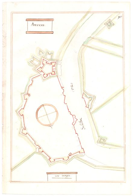
Subject: Antwerp, Belgium
Period: 1651 (circa)
Publication: Recueille de diuers plans de l'europe par NRenau Sedannois ingenieur lequel…
Color: Hand Color
Size:
8.3 x 12.4 inches
21.1 x 31.5 cm
Manuscript fortification plan of Antwerp, on the eastern bank of the Scheldt River. A simple compass rose orients north to the bottom right. Drawn in brown ink and delicately hand colored. Renau was a mathematician, military engineer and cartographer who worked on Blaeu's great atlas of city plans. The draftsman made pin-holes to indicate the ends of the straight segments in the drawings, which he then drew with a straight-edge. The manuscript atlas from which this plan came was dated 1651, although the plans may have been drawn later based on sketches and surveys made in 1651 after the Peace of Munster ended the Eighty Years' War in 1648. The paper stock is watermarked with a large shield enclosing a fleur-de-lys, surmounted by a crown, with a "4" and a "WR" at the base.
References:
Condition: A+
A bright, clean sheet.