Catalog Archive
Auction 143, Lot 484

"Aroe Insulae Delineatio Geometrica", Blaeu, (Family)

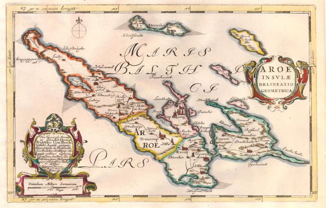
Subject: Aero Island, Denmark

Period: 1662 (circa)

Publication: Atlas Maior

Color: Hand Color

Size:
12 x 7.6 inches
30.5 x 19.3 cm
Download High Resolution Image
(or just click on image to launch the Zoom viewer)

A handsome map of Aero, a small Danish island in the Baltic Sea. The map was originally created by surveyor and cartographer Johannes Mejer in 1649 for an atlas on Schleswig Holstein. The plates were later sold to the Blaeu family, who republished them in 1662. The map is adorned with two strapwork cartouches, one of which credits Mejer. On a sheet of Dutch text (13.3 x 21.0").

References:

Condition: A

Clean, bright, hand-laid paper with a couple of short tears and a damp stain, all confined to blank margins.

Estimate: $110 - $140

Sold for: $170

Closed on 2/13/2013

Archived