Subject: North Sea
Period: 1650 (circa)
Publication: Atlantis Majoris Quinta Pars Orbem Maritimum
Color: Hand Color
Size:
21.6 x 17 inches
54.9 x 43.2 cm
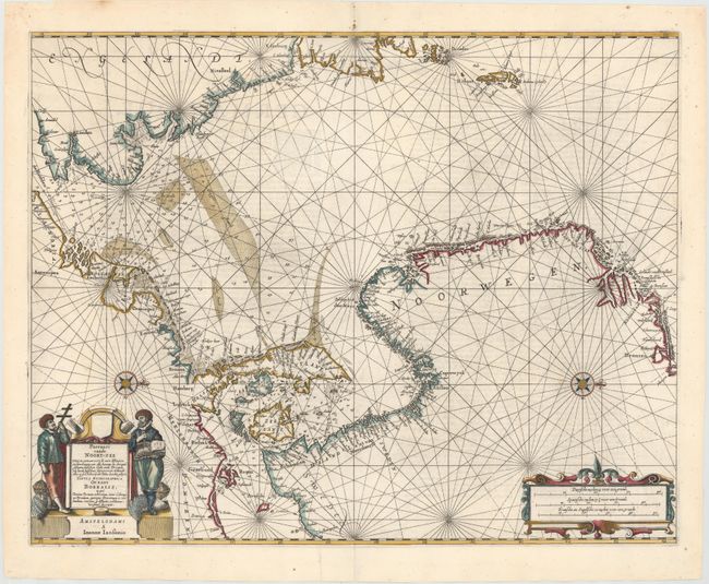
This sea chart of the North Sea shows good detail of the adjacent coastlines of England, Norway, Denmark, the Netherlands, and Belgium with numerous place names. The map provides excellent navigational information including soundings, the location of fishing banks, shoals and other navigational hazards. Two compass roses orient the map with north to the right. The map is further adorned with a strapwork cartouche containing the distance scale and surveyor figures flanking the title. French text on verso.
References: Tooley (MCC-71) #350.
Condition: A
A dark impression on a clean, bright sheet with light show-through of text on verso and professional repairs to short centerfold separations at top and bottom and a tear that extends 3" from centerfold at top.