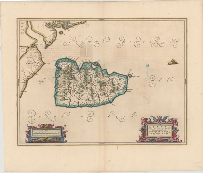
Subject: Arran, Scotland
Period: 1654 (published)
Publication: Atlas Novus
Color: Hand Color
Size:
20.7 x 15.3 inches
52.6 x 38.9 cm
Oriented with north to the left, this finely engraved map depicts the Island of Arran, with Brodick (Brodwick) on the eastern shore. The map, based on the work of Timothy Pont, famous surveyor of Scotland in the late sixteenth century, includes great detail of the rivers, cities, villages and mountains. The map is decorated with two elaborate cartouches. Latin text on verso.
Publication of Bleau’s atlas of Scotland (Atlas Novus, Volume V) in 1654 was a landmark publication in cartographic history. Most of the maps were based on the surveys of Timothy Pont, which had been done half a century earlier. The publication took over seven decades to bring to publication; delayed by wars, copyright restrictions, and only intermittent official support. The maps are scarce today due to the relatively short publication history of the atlas.
References:
Condition: A
Lovely color and wide margins with a bit of offsetting and show-through of text on verso.