Subject: Wales
Period: 1675 (circa)
Publication: Britannia
Color: Hand Color
Size:
16.2 x 12.8 inches
41.1 x 32.5 cm
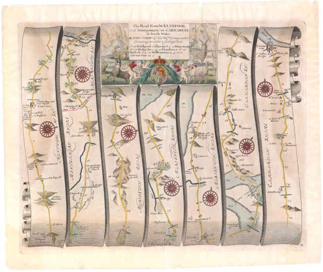
John Ogilby's 'Britannia' was published between 1675 and 1698. It is a landmark in the mapping of England and Wales. Its unique format constituted the first national road-atlas of any country in Western Europe. It was composed of maps of seventy-three major roads and cross-roads, presented in a continuous strip-form, on a uniform scale of one inch to a mile. Each beautiful map includes wonderful detail of the countryside with each strip containing a large compass rose to indicate changes in direction.
Attractive strip-style map covering the road from Welshpool to Carnarvan in seven strips totaling 82 miles. Each of the seven panels has a decorative compass rose to orient the traveler. The title cartouche is flanked by putti, mountain goats, and the royal coat of arms.
References:
Condition: B
There is a centerfold separation at bottom that extends 3" into the map image that has been repaired on verso with archival material and faint damp stains in the left and right side strip maps. Two tears in top blank margin that just pass neatline have been archivally repaired.