Subject: England and Scotland
Period: 1675 (circa)
Publication: Britannia
Color: Hand Color
Size:
18 x 12.7 inches
45.7 x 32.3 cm
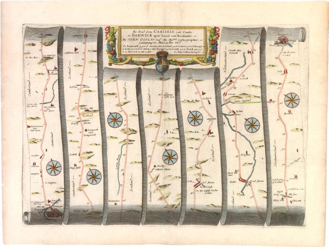
John Ogilby's 'Britannia' was published between 1675 and 1698. It is a landmark in the mapping of England and Wales. Its unique format constituted the first national road-atlas of any country in Western Europe. It was composed of maps of seventy-three major roads and cross-roads, presented in a continuous strip-form, on a uniform scale of one inch to a mile. Each beautiful map includes wonderful detail of the countryside with each strip containing a large compass rose to indicate changes in direction.
Beautiful strip-style road map with a title cartouche that features the agricultural bounty of the region. The map extends to Berwick and, importantly, is the only map in the 1675 Britannia that names and enters Scotland as well as showing the Scottish towns of Kelso and Jedburgh. This is also one of only five maps that notes the surveyor, Gregory King. According to Moreland and Bannister, Ogilby was the first to use the standard mile of 1,760 yards, the measurement used today.
References: Moorland & Bannister pp. 157-8; Shirley (BL Atlases) T.OGIL-4a #62.
Condition: B+
Watermarked paper with some creasing along centerfold.