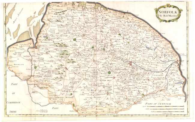
Subject: Norfolk, England
Period: 1695 (circa)
Publication: Camden's Britannia
Color: Hand Color
Size:
23.1 x 14.4 inches
58.7 x 36.6 cm
This map of Norfolk is an early county map to show the local roads. The county is divided into "Hundreds" (sometimes abbreviated as Hund on the map), an old English term for an area that would support a hundred families. It locates towns, buildings, forests, rivers, bridges and parks, which are noted by fenced areas. There is a decorative cartouche and three different distance scales. Sold by Abel Swale, Awnsham & John Churchil.
Morden was one of the first English cartographers to show longitudes measured from the meridian of St. Paul's Cathedral (shown in degrees at the bottom of the map) and time in minutes measure locally from the sun (shown at the top). The roads on his maps are based on Ogilby's earlier survey. The Britannia was first published by historian William Camden (1551-1623) in 1586. After the publication of the final edition of Britannia in 1637, the work was not published again until 1695 when Gibson revised and translated the text from the original Latin and included fifty maps, mostly of the English counties, prepared by Robert Morden, replacing the outdated maps of Christopher Saxton.
References: Shirley (BL Atlases) T.CAMD-5a.
Condition: B
Attractive color with minor soiling, one tiny rust hole in image near bottom, and a 2" tear at bottom left that has been repaired with old paper. Trimmed at top with complete loss of map border and small loss of map.