Subject: Europe
Period: 1854 (circa)
Publication:
Color: Printed Color
Size:
24 x 20 inches
61 x 50.8 cm
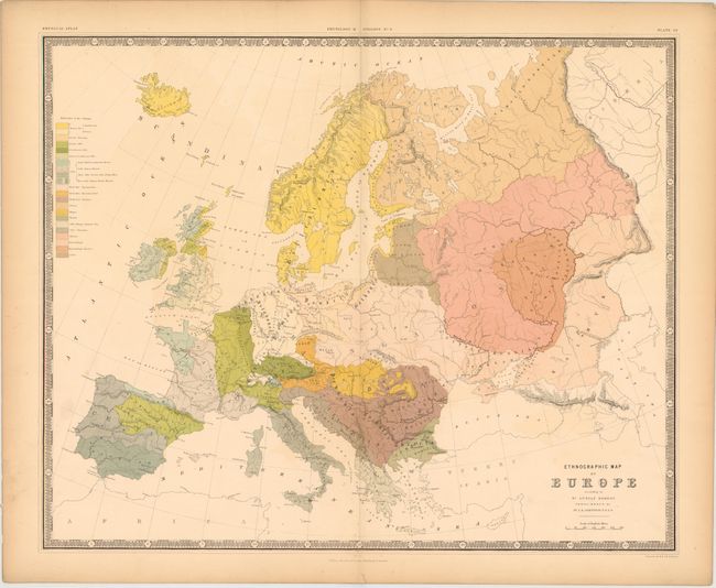
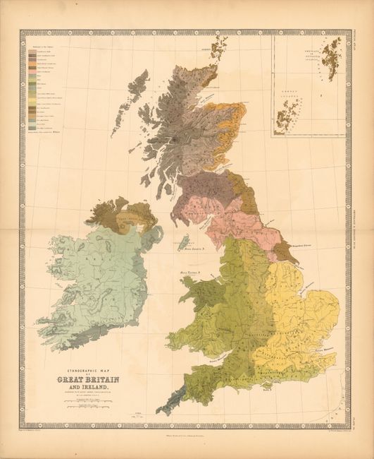
Nice lot of thematic maps from the English version of Heinrich Berghaus' Physikalischer Atlas, the first truly comprehensive thematic atlas. These are very early examples of printed color, the development of which made a huge impact on cartography in general and specifically on the graphic portrayal of geographical data on thematic maps.
These two maps show detailed views of the ethnology of the region by Dr. Gustaf Kombst. The map of Europe shows 22 different ethnic groups covering the area from Scandinavia to Russia. The map of Great Britain displays 20 different ethnic groups and includes an inset of the Shetland and Orkney Islands at top. Both maps are surrounded in a keyboard style border.
References:
Condition: B+
The map of Europe has centerfold separations that extends 2" into the image at top and 1/8" into image at bottom, as well as a few unobtrusive spots. The map of Great Britain has centerfold separations that extend 1" into the image at right and 2" into image at left, although the left-hand separation has been partially closed on verso. Both maps have faint offsetting and a hint of toning along sheet edges.