Subject: Europe
Period: 1578 (published)
Publication: Cosmographey oder Beschreibung aller länder
Color: Black & White
Size:
13.5 x 10.2 inches
34.3 x 25.9 cm
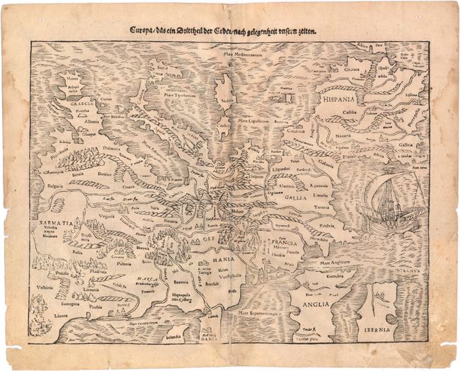
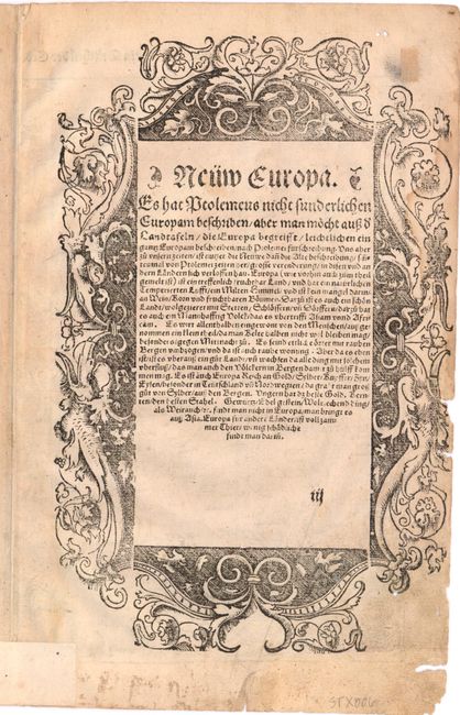
This is one of the earliest obtainable maps of the European continent. Its unusual orientation, with north at the bottom of the sheet and the Mediterranean Sea at top, also makes it one of the most interesting maps of Europe. Mountains, forests, rivers and towns fill the land and in the Atlantic Ocean there is a large sailing ship. Sebastian Munster was the first to make individual maps of each continent, and this map is from that series. The map was issued in both Munster's Geographia and Cosmographia. The verso has a title block with German text and is illustrated with an exquisite figural engraving generally attributed to Hans Holbein.
References: Potter p.98; Mickwitz & Miekkavaara #158 [3].
Condition: B
Watermarked paper with even toning, light soiling, and one small worm hole in image at bottom left. The impression is slightly uneven, with minor facsimile of several place names. A bottom centerfold separation and adjacent tear, both just entering neatline, have been archivally repaired. There are a few light damp stains and small chips and worm tracks in blank margins.