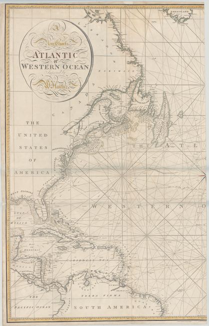
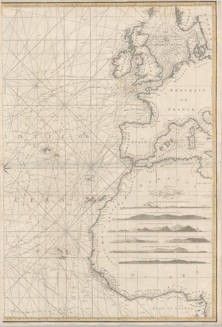
Subject: North Atlantic Ocean
Period: 1814 (circa)
Publication:
Color: Hand Color
Size:
24.9 x 37 inches
63.2 x 94 cm
This is an incredible, large-scale chart of the north Atlantic Ocean with excellent coastal detail of North America and the Caribbean, northern South America, western Europe, and northwestern Africa. There is an abundance of information on soundings, anchorages, banks, shoals, currents, tracks of various ships, and coastal place names. The interior of Africa is filled with 7 coastal views. Engraved by J. Stephenson. Size is for each sheet; if joined, the map would measure approximately 49.5 x 37".
At the end of the 18th century Britain played a leading role in chart making and William Heather was among the most prominent cartographers of the period. He succeeded Mount and Page and then established a Naval Academy and the Naval Warehouse, which provided nautical instruments, charts and instructional texts on navigation.
References:
Condition: B+
A nice impression on heavy paper with light soiling and a few small pencil marks. There are minor archival repairs to the folds on both sheets, a tiny hole along the St. Lawrence River near Vermont, and two small worm tracks on the eastern sheet. Very good condition for a map of this size.