Subject: South America
Period: 1719 (circa)
Publication: L'Atlas Francais
Color: Hand Color
Size:
25.3 x 18 inches
64.3 x 45.7 cm
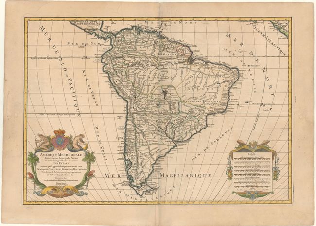
This is a handsome and large map of the continent decorated with elaborate title and scale of miles cartouches balancing the lower portion of the map. The continent is divided into the French, Spanish, Portuguese and Dutch possessions. The fourteen coastal Capitaineries created by the Portuguese are outlined in Brazil. The course of the Amazon is delineated in a fairly accurate manner, yet it shows the river's source in a fascinating, interlacing maze of waterways. The Rio Paraguay erroneously begins at a lake named Xarayes in the middle of Brazil. The title cartouche features two natives and tropical birds, engraved by C. Simonneau. The map was engraved by Louis Cordier. This edition was published by Alexis-Hubert Jaillot's son, Bernard Jean-Hyacinthe, who inherited the business after his father's death in 1712.
References: Pastoureau, Jaillot II G [6].
Condition: B+
A nice impression with wide margins, light soiling, and a couple of printer's creases.