Subject: World
Period: 1713 (circa)
Publication:
Color: Black & White
Size:
7 x 5 inches
17.8 x 12.7 cm
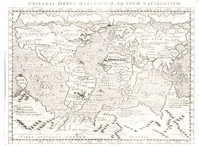
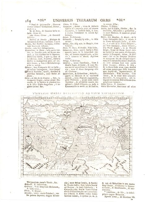
This small mariner's map is based on one of the most important world maps of the 16th century; Gerard Mercator's multi-sheet map of 1569. The map reflects the belief in wide Arctic sea passages and depicts a huge southern continent, to which Magini has added fanciful ranges of mountains. A fine network of rhumb lines criss-cross the map and the oceans are stipple engraved in the Italian style. Printed on a full sheet of Latin text (8.7 x 12.2") both above and below the map image. This is a later reissue of the map, with the first edition appearing in 1596.
References: Shirley #196; Mickwitz & Miekkavaara #226 [64].
Condition: A
Slightly uneven impression with a few tiny printer's creases along the lower platemark.