Catalog Archive
Auction 143, Lot 330

"West Indies from the Best Authorities", Kitchin, Thomas

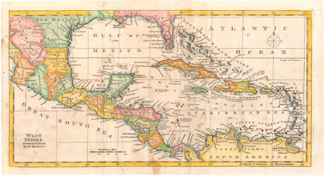
Subject: Gulf of Mexico & Caribbean

Period: 1782 (circa)

Publication:

Color: Hand Color

Size:
13.6 x 7 inches
34.5 x 17.8 cm
Download High Resolution Image
(or just click on image to launch the Zoom viewer)

This nicely detailed map of the West Indies extends to cover parts of North America, Central America, and the northern coast of South America. Several large islands make up Florida's southern tip, and a mountain range is depicted in its peninsula. The map is filled with coastal place names and shows important rivers and mountains.

References: Sellers & Van Ee #1709.

Condition: B

Issued folding, with some creasing along the folds and scattered stains. Three small tears, one within the map image, have old paper repairs on verso. One of the folds is also backed in old paper to strengthen the sheet.

Estimate: $100 - $140

Sold for: $240

Closed on 2/13/2013

Archived