Subject: United States & Mexico
Period: 1835 (circa)
Publication:
Color: Black & White
Size:
9.8 x 7.8 inches
24.9 x 19.8 cm
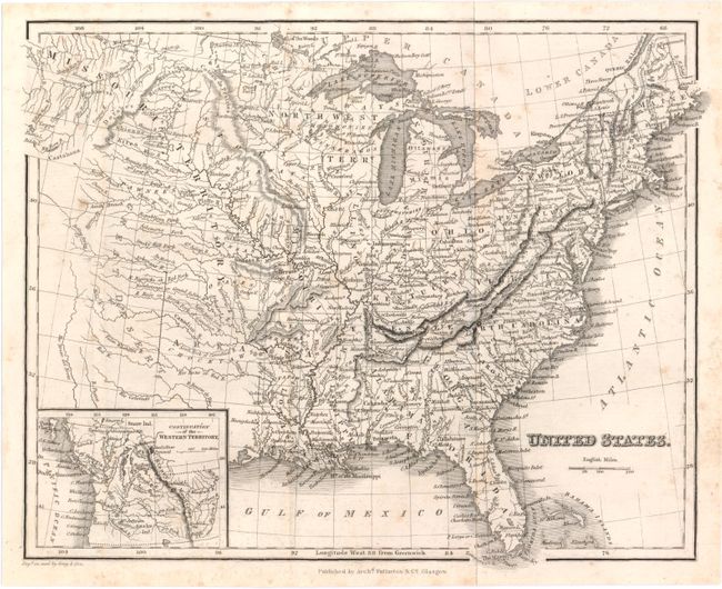
A. United States. This small map of the United States displays a huge Missouri Territory, Northwestern Territory, and an inset with the Continuation of the Western Territory. Detail west of the Mississippi River is limited to the locations of Indian tribes, rivers and topography. The area from the Platte River to the Red River is named the Great Desert. Engraved by Gray & Son.
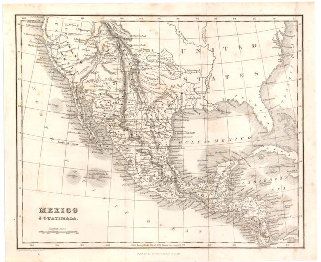
B. Mexico & Guatimala. A detailed map that shows an early Texas as part of the state of San Luis Potosi in Mexico, with San Antonio named. California and the Southwest are also part of Mexico, and a number of non-existent rivers flow from two fictitious lakes -- L. Timpanogos and L. Teguayo (probably Salt Lake) -- including the Buenaventura, S. Felipe, and Los Mongos. Engraved by Gray & Son.
References:
Condition: B+
Issued folding with light scattered foxing.