Subject: Louisiana
Period: 1814 (circa)
Publication: General Atlas
Color: Hand Color
Size:
17.3 x 15.8 inches
43.9 x 40.1 cm
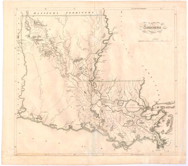
This is one of the earliest large format maps of the state to appear in a commercial atlas. There is very little development except along the Mississippi River. However, the map includes nice detail of the existing roads, towns, rivers, and lakes. A reduced version of this map from Carey's American Pocket Atlas [1813] was the first printed map of Louisiana as a state. This enlarged edition appeared in his General Atlas the following year. It was most likely compiled by Samuel Lewis, Carey's principal mapmaker, although there is no engraver's imprint.
References: Lemmon, Magill & Wiese #74.
Condition: B
Light soiling with archival repairs to a couple of separations along the centerfold and to a small tear in an unengraved area of map adjacent to centerfold at bottom. Remargined at bottom to accommodate framing.