Subject: Kentucky
Period: 1823 (published)
Publication: A General Atlas…
Color: Hand Color
Size:
19 x 11.6 inches
48.3 x 29.5 cm
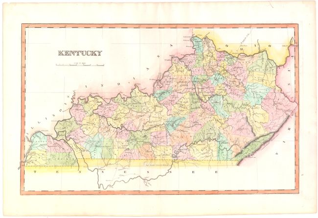
This map of Kentucky depicts county lines up-to-date for 1821, with the recent organization of Todd, Trigg, Grant and Perry counties. The southwest corner of the state, which was purchased from the Chickasaw Indians in 1818 through the Jackson Purchase, shows preliminary county lines for Hickman, Graves, Calloway, and McCracken. There is good detail of rivers, mountains, roads, and towns throughout the map. Lucas' General Atlas is known as one of the finest general atlases produced in the U.S. at the time, due to the high quality paper, superior engraving quality, and attractive coloring style. Engraved by B. T. Welch.
References: Phillips (Atlases) #742-66.
Condition: A
Original color with one tiny tear in top margin and short top and bottom centerfold separations, all far from map image, have been archivally repaired.