Subject: Indiana
Period: 1823 (published)
Publication: A General Atlas…
Color: Hand Color
Size:
9 x 11.2 inches
22.9 x 28.4 cm
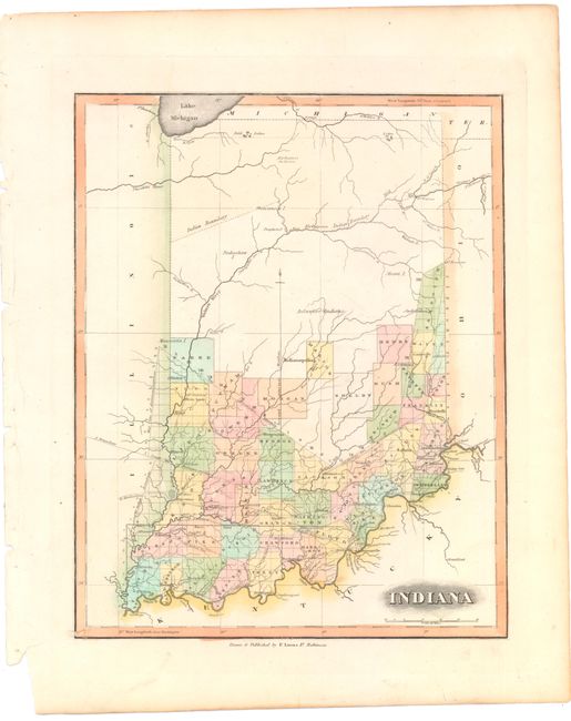
This map of Indiana shows early county development and locates major cities, rivers, and roads. The central and northern parts of the state remain mostly unorganized, and include references to the Kickapoo, Miami, Pinkashaw, Delaware, and Shawanese Indians. Dotted lines indicate the northern and southern boundaries of the Harrison Purchase, as well as old Indian lines. Lucas' General Atlas is known as one of the finest general atlases produced in the U.S. at the time, due to the high quality paper, superior engraving quality, and attractive coloring style.
References: Phillips (Atlases) #742-71.
Condition: A
Original color on watermarked paper with faint toning.