Subject: Hawaii
Period: 1833 (circa)
Publication:
Color: Black & White
Size:
9.3 x 7.1 inches
23.6 x 18 cm
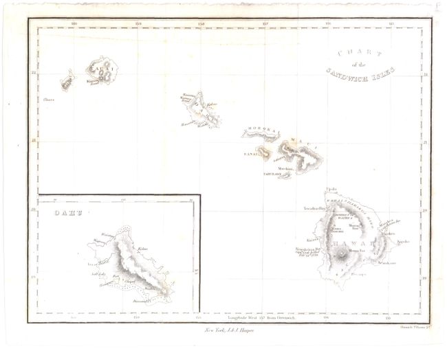
This example names each of the Hawaiian islands, as well as several towns, bays and mountains. This attractive map shows the topography with hachure, and includes an inset of Oahu at lower left. A note regarding the death of Capt. Cook appears in Kearakekua Bay, on the southwestern side of the island of Hawaii. The map is nearly identical to the map that appeared in William Ellis' 1826 "Narrative of a Tour through Hawaii," which was the first cartographic portrayal of volcanic activity in Hawaii.
References:
Condition: B+
Issued folding with some light foxing and a binding trim at lower right margin that has been replaced with old paper. An extraneous crease runs through top of map.