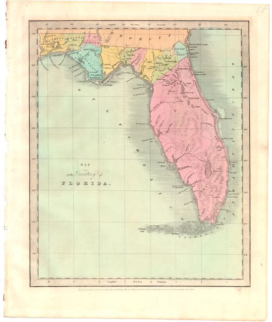
Subject: Florida
Period: 1834 (dated)
Publication: New Universal Atlas
Color: Hand Color
Size:
10.6 x 12.8 inches
26.9 x 32.5 cm
This rare early map of Florida shows county development and railroad lines in the northern part of the territory, prior to its statehood in 1846. The map includes the counties of Escambia, Walton, Jackson, Washington, Leon, Jefferson, Madison, Duval, Nassau and Gadsden, which is shown but unnamed. The county of St. John's makes up the entire peninsula, which most closely matches its 1822 formation. Based on the 1834 date, many counties are missing, including Alachua (formed 1824), Hamilton (1827), Columbia (1832), and Franklin (1832). Additionally, there is no county development in central or southern Florida, although Mosquito, Hillsborough, and Monroe were formed by this time.
References:
Condition: A
Original color with minor toning.