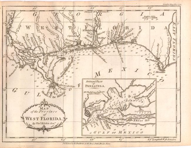
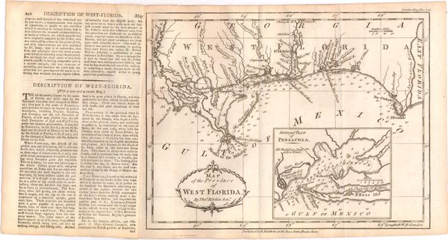
Subject: Florida
Period: 1781 (dated)
Publication: London Magazine
Color: Black & White
Size:
9.6 x 7.3 inches
24.4 x 18.5 cm
This scarce chart of the British colony of West Florida is filled with soundings along the coastline and extends to the eastern tip of Louisiana, including New Orleans. West Florida remained loyal to Britain during the American Revolution, and was a haven for Tories fleeing from the Thirteen Colonies. After Spain entered the war in 1779, the governor of Spanish Louisiana began attempts to gain control of the region, gaining control of Mobile in 1780 and besieging Pensacola in 1781. A large inset map depicts Pensacola Harbor with a note that Pensacola was destroyed in 1719, when the French captured it from the Spanish in a previous conflict attesting to its strategic importance to the colonial powers in North America. Attached to the preceding sheet of text with a description of the map.
References: Jolly #LOND-341; Sellers & van Ee #1652.
Condition: A
Issued folding with minor toning and faint offsetting.