Subject: Alabama
Period: 1823 (published)
Publication: A General Atlas…
Color: Hand Color
Size:
8.8 x 11.3 inches
22.4 x 28.7 cm
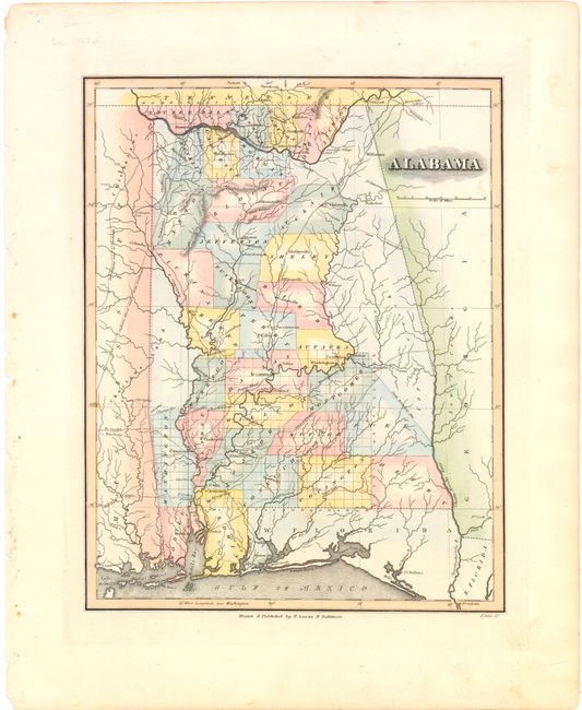
Fine early map of the state of Alabama showing its county development and detailing the roads, cities, and rivers. Indian lands are shown, with the area to the west labeled Choctaws Land and the unorganized area to the east divided into the Upper Creeks and Lower Creeks. The map extends south to include West Florida. Lucas' General Atlas is known as one of the finest general atlases produced in the U.S. at the time, due to the high quality paper, superior engraving quality, and attractive coloring style. Engraved by J. Cone.
References: Phillips (Atlases) #742-69.
Condition: A
Original color on watermarked paper with a few tiny, insignificant spots.