Subject: Western United States
Period: 1846 (dated)
Publication:
Color: Hand Color
Size:
8 x 10.4 inches
20.3 x 26.4 cm
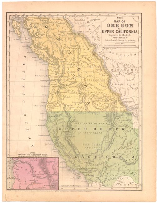
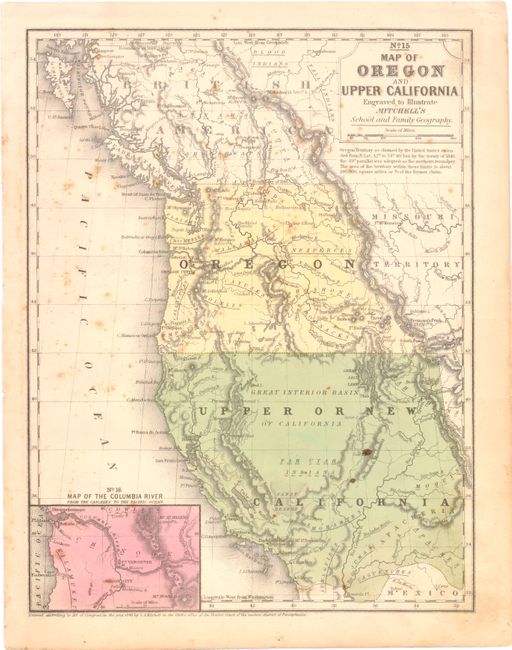
This lot includes two states of Mitchell’s map which covers the area from the Rocky Mountains to the Pacific. The first map features the U.S. border with Canada at 54°40' with the notation "Boundary of 1824" while the second shows the boundary at the final 49th parallel.
In both maps, Upper California extends eastward to the Rio Grande and Oregon Territory extends to the Continental Divide. Shows the Oregon Route (Oregon Trail) in good detail as it winds from the Sweetwater River through South Pass to Oregon City. Numerous Indian tribes and villages and forts are located. An early depiction of the Great Basin is here called the Great Interior Basin of California. At lower left is the inset Map of the Columbia River from the Cascades to the Pacific Ocean.
References:
Condition: B
Light toning and soiling with some scattered foxing on the second map.