Catalog Archive
Auction 143, Lot 213

"Map of Nebraska, Dakota. Montana, and Wyoming", Williams, J. David

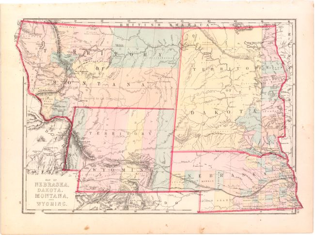
Subject: Central United States

Period: 1875 (circa)

Publication:

Color: Hand Color

Size:
17.2 x 12.2 inches
43.7 x 31 cm
Download High Resolution Image
(or just click on image to launch the Zoom viewer)

Detailed and uncommon regional map hand colored by counties and showing towns, topography, rivers, railroads, etc. The Snake River is misnamed the Columbia in southern Idaho. Wyoming Territory shows little development with only five counties noted. Dakota Territory is mostly unorganized except for a few counties in the extreme southeast tip. Filled with place names including forts and geographical features used by immigrants. Map of Colorado, Utah, New Mexico, and Arizona on verso.

References:

Condition: B+

A few unobtrusive spots and one tear in left blank margin that has been repaired on recto with archival tape.

Estimate: $90 - $130

Sold for: $65

Closed on 2/13/2013

Archived