Subject: Central United States
Period: 1836 (published)
Publication: Doc. 333
Color: Black & White
Size:
6.55 x 9.5 inches
16.6 x 24.1 cm
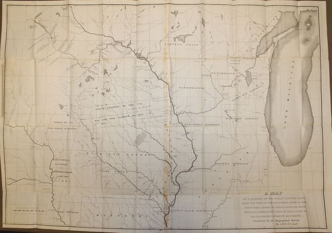
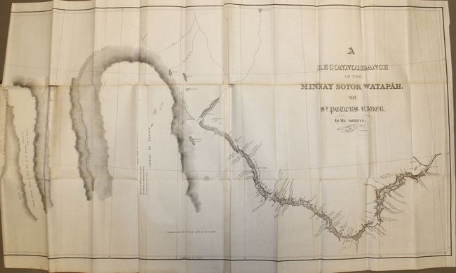
This report describes the second of G.W. Featherstonhaugh's extensive geological reconnaissances into the Midwest which, together with the first report, comprised the first Federal geological survey. Although much preliminary matter is presented, original descriptions and discussion of the geologic structure and stratigraphy over the terrain covered is also included. Octavo, 168 pp. with 4 plates showing geological profiles and two large folding maps, A Reconnoissance of the Minnay Sotor Watapah or St. Peter's River to its Sources and A Map of a Portion of the Indian Country Lying East and West of the Mississippi River... (40 x 27.5"), which is joined on two sheets. The latter map is considered to be among the best maps of the upper Mississippi River published prior to Nicollet's landmark map of 1843. The map shows the locations of various forts and Indian villages, lands ceded to the United States from various Indian tribes, the Half Breed Tract in southern Iowa, Carver's Grant, and the town of Commerce, Illinois, which would be purchased by the Mormons a few years later and renamed Nauvoo. Printed by Gales and Seaton.
References:
Condition: B+
The maps are generally clean and bright. The map of the St. Peter's River has a number of splits at fold intersections and some light toning along the folds. The map of Indian Country is toned only along the joint. Text shows light foxing. Housed in modern wrappers.