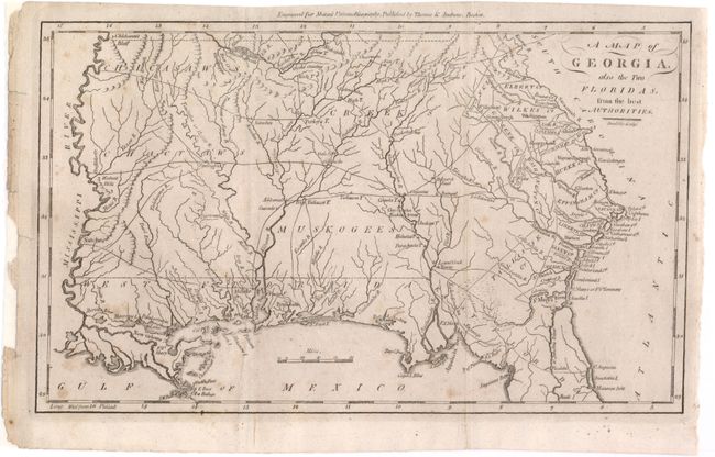
Subject: Southern United States, Georgia
Period: 1796 (published)
Publication: Morse's Universal Geography
Color: Black & White
Size:
12 x 7.3 inches
30.5 x 18.5 cm
This is an early American map depicting Georgia Territory extending from the Atlantic seaboard to the Mississippi River, with East and West Florida along the Gulf Coast. Most of the interior is dominated by various Indian tribes, including the Chickasaws, Creeks, Chactaws, and Muskogees with several prominent villages located. Fifteen early counties are shown along the Atlantic coast and the Savannah River. Several trading paths are noted in the west. Mobile, Pensacola and New Orleans are noted. Engraved by Amos Doolittle and published by Thomas & Andrews, Boston.
References: Wheat & Brun #614.
Condition: B+
Issued folding and now flattened with some isolated foxing and light toning. A few edge tears confined to the blank margins have been closed with tissue on verso.