Subject: World
Period: 1630 (circa)
Publication:
Color: Hand Color
Size:
21.3 x 15.8 inches
54.1 x 40.1 cm
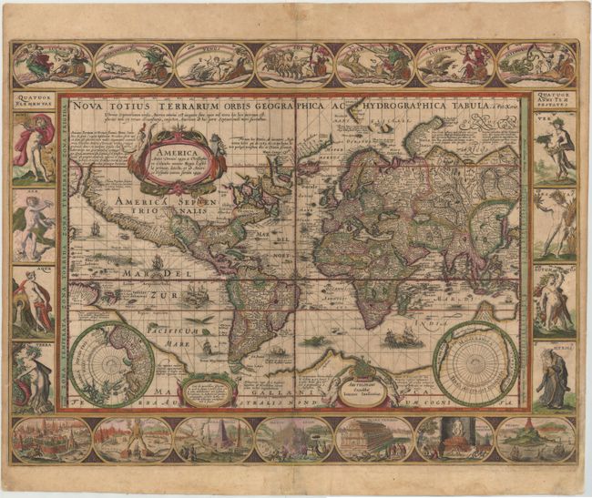
Petrus Kaerius's uncommon version of Blaeu's carte-a-figure's map of the world is a superb example of the map-maker's art. The interesting and detailed border decorations are identical to those of Blaeu and consist of the seven planets across the top, the seven wonders of the world along the bottom and the four elements and four seasons flanking the map. Geographically the map itself is also copied from Blaeu, but includes more legends and additions referring to explorations in the Arctic. A long note near the cartouche discusses the theory that the straits of Anian and Davis link to form a Northwest Passage. He also added rhumb lines radiating from compass roses arrayed across the equator. The map was first published in 1608. In 1621 Kaerius sold his plates to Jan Jansson who then issued the map with his imprint. This example is the fourth state with Jansson's imprint and no date. German text on verso.
References: Shirley #264.
Condition: B+
Attractive color with light toning and soiling, professional repairs along the centerfold, and a tiny archivally repaired tear just above the Black Sea. There are several small chips and tears in blank margins that have been archivally repaired.