Catalog Archive
Auction 143, Lot 192

"Virginia and Maryland", Moll, Herman

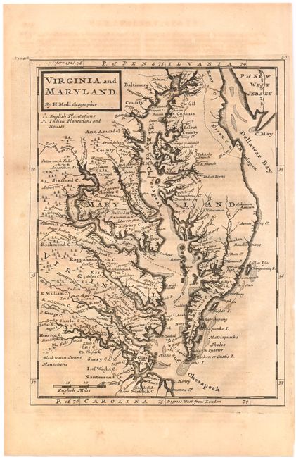
Subject: Colonial Mid-Atlantic

Period: 1740 (circa)

Publication: Modern History

Color: Black & White

Size:
8 x 10.7 inches
20.3 x 27.2 cm
Download High Resolution Image
(or just click on image to launch the Zoom viewer)

This map of the eastern coast of Virginia, Maryland, and the Chesapeake Bay was based on Augustine Hermann's map of 1673. The map labels counties, towns, water ways, Indian lands, plantations, and provides useful notations such as "the swamp here not passable." A key under the title identifies English plantations and Indian plantations and houses. Published in London in Thomas Salmon's Modern History: or the Present State of All Nations.

References: Stephenson & McKee #II-16; Shirley (BL Atlas) G.SALM-1c #43.

Condition: B+

Strong impression with light toning and offsetting.

Estimate: $500 - $650

Sold for: $475

Closed on 2/13/2013

Archived