Subject: New England & Mid-Atlantic
Period: 1817 (dated)
Publication: New General Atlas
Color: Hand Color
Size:
23.5 x 19.5 inches
59.7 x 49.5 cm
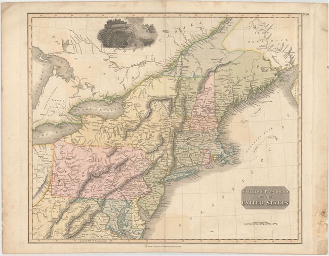
Very nicely engraved and detailed map covering from Virginia to the District of Main, which reflects the British view of the border. The map contains several interesting remnants of post Revolutionary War features. The name Indiana appears in present-day West Virginia. This region was a major contention between the private Indiana Land Company and the State of Virginia in the latter part of the 18th century. The Connecticut Reserve (bounty land grant) appears in the Cuyahoga valley of present-day Ohio. The Township of the Six Nations is shown north of Lake Erie in a Great Track of Woodland. The map extends to provide good detail on the course of the St. Lawrence and Utawas Rivers. There is a large decorative engraved view of Niagara Falls at top center. Engraved by Hewitt.
References:
Condition: B
Original color with light offsetting, a few tiny spots, and minor extraneous creases at the top corners of the map image. There is a damp stain in right blank margin, far from map, with additional old paper pasted over the damp stain on recto.