Subject: Colonial New England & Mid-Atlantic
Period: 1777 (circa)
Publication: Il Gazzettiere Americano
Color: Hand Color
Size:
11.7 x 8.1 inches
29.7 x 20.6 cm
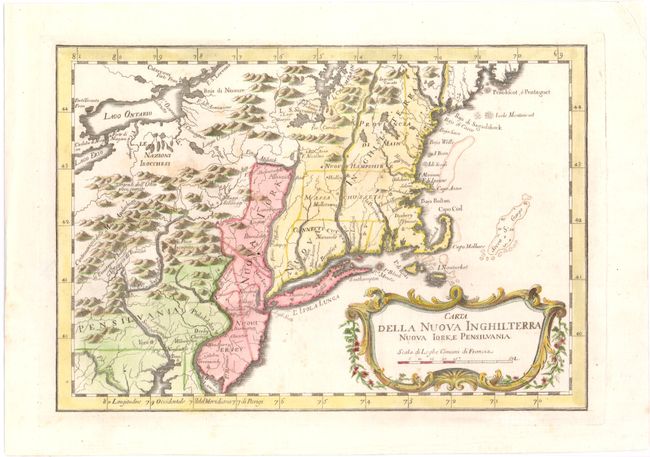
This French & Indian War period map details the English colonies from Pennsylvania through to Castine, Maine with their early boundaries. It is fully engraved with topographical features and includes many early place names. The colonies are shown confined east of the Allegheny Mountains with the Nazioni Irocchesi, Indian villages, and several French forts located west of the mountains. It extends to show Lake Ontario and most of Lake Erie. A flourishing French rococo-style cartouche with distance scale decorates the map. This is an Italian edition of Bellin's map that was first published in 1757.
References: McCorkle #763.2; Sellers & Van Ee #722.
Condition: A
Watermarked paper with wide margins and minor soiling.