Subject: Eastern United States
Period: 1844 (circa)
Publication: National Atlas
Color: Printed Color
Size:
24.7 x 19.8 inches
62.7 x 50.3 cm
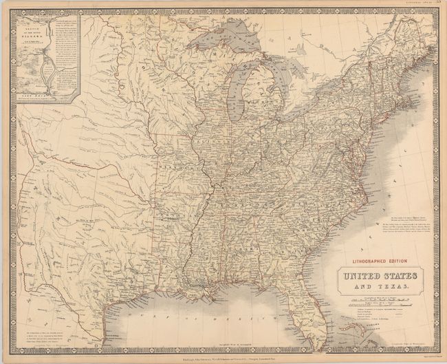
Detailed map of the eastern half of the United States featuring an Independent Republic of Texas, shown in an unusual stovepipe configuration. All of the important settlements in Texas are noted including the communities along the Rio Grande. A note in the bottom left corner states "The Independence of Texas was formally declared in March 1836. It was recognized by Great Britain in Novr. 1840; and has been acknowledged by the United States, France, Holland and Belgium." The territories of Wisconsin and Iowa are both depicted, with Iowa shown between the Mississippi and Missouri Rivers and extending to the Canadian border. Includes an inset at top Sketch of the River Niagara. From Johnston’s early lithographed edition of his National Atlas.
References: Day #1431.
Condition: A
There are two tiny wormholes in the top neatline, else fine.