Subject: United States
Period: 1868 (dated)
Publication:
Color: Printed Color
Size:
55 x 28 inches
139.7 x 71.1 cm
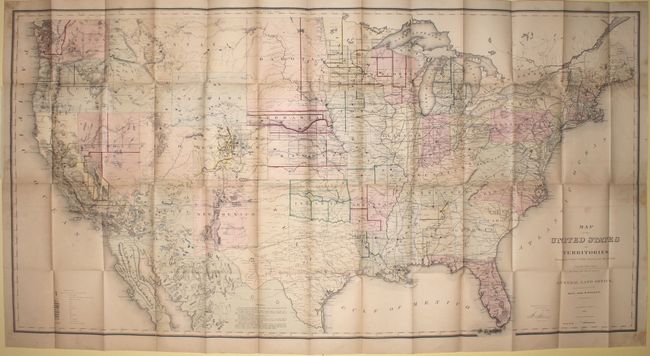
Between 1866 and 1870, the General Land Office issued a series of maps to illustrate the progress of public surveys, the progress of the railroad system, and the locations of Land Offices, western Land Grants, and mineral deposits. These remarkable maps provide a detailed view of the westward expansion that followed the Civil War. The maps (and reports) were distributed both domestically and internationally as incentive to investment and immigration.
This edition shows the progress of the surveys and settlement as of 1868. The legend identifies 15 different features including gold, silver, copper, iron and tin deposits with very good detail of the surveying efforts that were underway from Ohio west to California. The map shows the Transcontinental Railroad with flags delineating the progress of the lines, as well as a small sliver of Dakota Territory west of Wyoming that was eventually absorbed by Montana Territory.
References:
Condition: B+
An overall very good example of this large format map, with a number of small splits at fold intersections. There is faint offsetting and some foxing primarily along the sides of the sheet.