Catalog Archive
Auction 143, Lot 158

"A New Map of the British Empire in Nth. America, Drawn from the Latest Authorities", Kitchin, Thomas

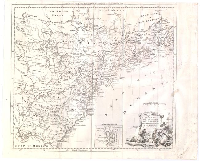
Subject: Colonial United States & Canada

Period: 1782 (circa)

Publication: Millar's New Complete & Universal System of Geography

Color: Black & White

Size:
14.9 x 13.2 inches
37.8 x 33.5 cm
Download High Resolution Image
(or just click on image to launch the Zoom viewer)

This handsome Revolutionary War period map covers the area east of the Mississippi River and from James Bay to the Gulf of Mexico. It shows the provinces and colonies, towns and cities, Indian villages and tribal territory, along with mines, forts and other points of interest. An inset depicts southern Florida as a vast group of islands. The Carolinas and Georgia extend to the Mississippi River. The map is adorned with an allegorical title cartouche.

References: McCorkle #782.10; Sellers & Van Ee #180.

Condition: B+

Issued folding with some light printer's ink residue and a spot of soiling along border at right.

Estimate: $475 - $600

Sold for: $240

Closed on 2/13/2013

Archived