Subject: Colonial United States & Canada
Period: 1756 (dated)
Publication:
Color: Hand Color
Size:
22.5 x 16.7 inches
57.2 x 42.4 cm
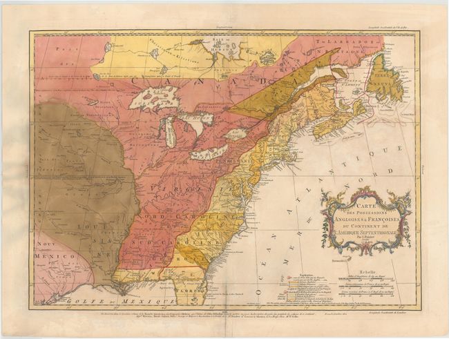
This fascinating map is the second state of one of the best maps of the colonies on the eve of the French and Indian War. Mr. Palairet was the Agent to the States-General in London. In 1755 he published the pamphlet "A Concise Description of the English and French Possessions in North-America." The map was engraved by Thomas Kitchen and intricately colored to show the disputed lands, forts, roads, and the extent of settlement in the region. Embellished with a delicately engraved title cartouche.
References: McCorkle #755-22; Sellers and Van Ee #56; Tooley (America), p. 62 #18-c.
Condition: C+
A nice impression on watermarked paper with light soiling and an archivally repaired centerfold separation that enters 2" into map at bottom. There are a number of small cracks caused by the oxidation of the original green pigment that have all been archivally reinforced on verso. The date in the title cartouche has been changed in brown manuscript ink to 1763.