Subject: Colonial United States & Canada
Period: 1755 (dated)
Publication:
Color: Hand Color
Size:
18 x 14.3 inches
45.7 x 36.3 cm
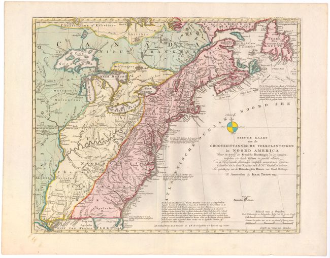
This is a handsome illustration of the British and French possessions at the beginning of the French and Indian War. It is a very detailed map of the disputed region between the Mississippi River and the Appalachian and Allegheny Mountains, which is graphically depicted by the original color and delineated by a dashed line for the French claims and a dotted line for the British claims. The frontier forts of both nations are located, as are colonial settlements and Indian villages. The imaginary islands in Lake Superior are evident, including I. Philippeaux, Ponchartrain, and St. Anne. The map was based on information from John Mitchell's great map of North America. Although this map bears the date 1755, the same as Mitchell's map, it was not published until 1769.
References: McCorkle #755.39 &769.1; Sellers and Van Ee #63.
Condition: A
Clean, bright, watermarked paper with a printer's crease adjacent to centerfold.