Subject: North American Cities - New York, Boston, Charleston
Period: 1741 (circa)
Publication: Atlas Nouveau
Color: Hand Color
Size:
24.2 x 19.2 inches
61.5 x 48.8 cm
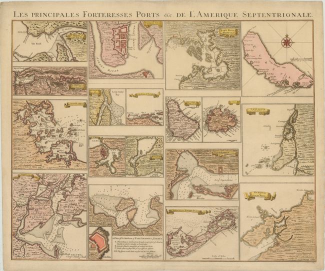
This rare chart shows 18 separate maps of harbors and islands throughout North and South America. This sheet was created to accompany Covens & Mortier's reduction of Henry Popple's extremely influential map of the British possessions in North America (1733). Popple's chart was originally published in 20 sheets and the Amsterdam firm of Covens and Mortier reduced it to four, more manageable sheets. The maps included on this chart were derived from the insets on Popple's map, and feature towns, forts, topography, soundings, shoals, and anchorages. Included are the harbors of New York, Boston, Charleston, Providence, St. Augustine, Anapolis Royal (Nova Scotia), Placentia (Newfoundland), Havana (Cuba), St. Iago (Santiago, Cuba), Kingston (Jamaica), Port Antonio (Jamaica), Fort Royal (Martinique), Cartagena (Colombia), and Portobelo (Panama), as well as the islands of Barbados, Antiqua, Bermuda, and Curacao.
References: Cumming #249.
Condition: A
A nice impression on heavy, watermarked paper.