Subject: North America
Period: 1860 (dated)
Publication:
Color: Hand Color
Size:
21.8 x 29.8 inches
55.4 x 75.7 cm
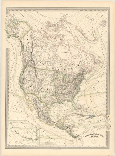
This large, handsome map of North America provides considerably more detail than most continental maps of this period, including political boundaries, towns, roads, forts, Indian tribes, and railroads. The map is filled with interesting information concerning the ocean currents and shipping lanes with great detail of even tiny islands. In the United States the states are delineated to the Mississippi River valley and Texas. But the western territories are not delineated and California is not shown as a state. Instead the region is marked with extensive information on the various Indian districts. A large inset map details the Aleutian Islands of Alaska.
References:
Condition: A
Bright and clean with original color. There are a couple minor repaired tears in the blank margins.