Subject: North America
Period: 1857-68 (circa)
Publication:
Color: Hand Color
Size:
12.8 x 15.6 inches
32.5 x 39.6 cm
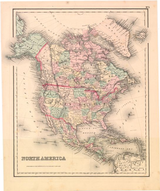
A. North America, by J.H. Colton, circa 1857. This attractive map shows a large Utah and New Mexico Territory as well as a Nebraska Territory that stretches to the Canadian border. Kanzas Territory occupies present-day Nebraska, while Washington and Oregon territories stretch to the Rocky Mountains. Attractive hand color locates cities and towns, rivers and topography by hachure. Condition: Light toning and a few minor spots. (B+)
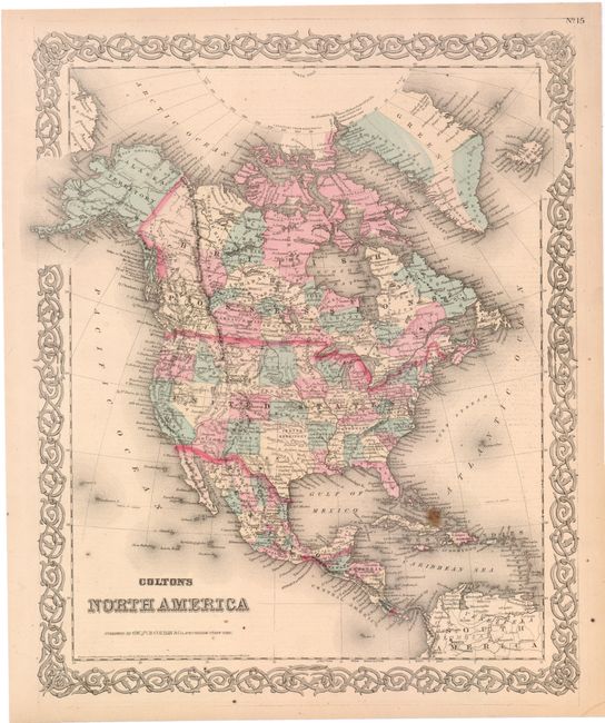
B. Colton's North America, by G.W. & C.B. Colton, circa 1868. This is a later edition of the map as the western territories are shown with their final borders. Nevada includes its southern tip and Alaska is shown as a U.S. possession. Surrounded by a decorative scroll border. Condition: Light toning with a few small stains, including a 3/8" spot in the Bahamas. (B+)
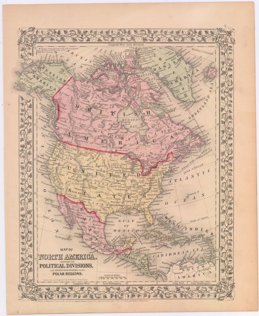
C. Map of North America, Showing Its Political Divisions, and Recent Discoveries in the Polar Regions, by Samuel Augustus Mitchell, dated 1866 (10.5 x 13.3"). Covers the area from Greenland south to Panama, with the tracks of McClure and Kane shown in the Arctic. Condition: (A)
References:
Condition:
See descriptions above.