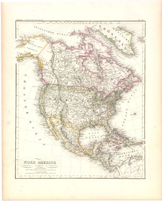
Subject: North America
Period: 1850-53 (dated)
Publication: Meyer's Auswanderungs-Atlas
Color: Hand Color
A. Nord America, dated 1853 (11.8 x 14.4"). Nice map of the continent from Meyer’s Auswanderungs Atlas. In the Southwest, the border with Mexico follows the Gila River, indicating a pre-Gadsden Purchase configuration. The west is dominated by a huge Utah Territory that spans from the Continental Divide to California. Alaska is Russisches America. The map extends to show all of the West Indies. Condition: Original color with just a hint of toning in the blank margins. (A)
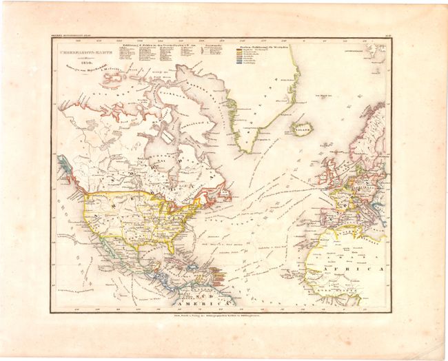
B. Ueberfahrts-Karte, dated 1850 (14.1 x 11.3"). Shows the various trade routes between North America and Europe. A key at top identifies states and territories as well as European claims in the West Indies. Condition: Light foxing with a damp stain confined to the top blank margin. (B)
References:
Condition:
See descriptions above.