Subject: North America
Period: 1844 (published)
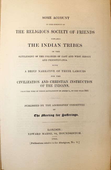
Publication: Religious Society of Friends towards the Indian Tribes…
Color: Hand Color
Size:
6 x 9 inches
15.2 x 22.9 cm
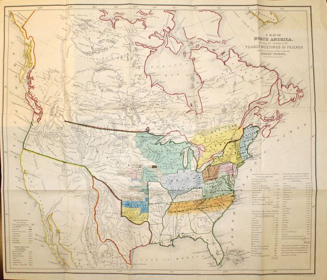
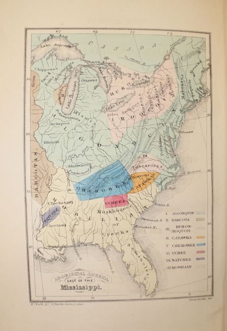
This lot contains two interesting maps illustrating the status of Indian nations in the United States in the middle of the 19th century. The two maps are included in the original Some Account of the Conduct of the Religious Society of Friends Towards the Indian Tribes in the Settlement of the Colonies of East and West Jersey and Pennsylvania, which was published by the Religious Society of Friends, or Quakers as they are more commonly known. It was produced for the Aborigines' Committee of the Meetings of Sufferings in London, 1844. The Quakers held these meetings every year, in which they focused on the wrongs suffered by aboriginal peoples all over the world. Both of these maps were drawn by Jim Bowden and lithographed by H. Clark. The report, 247 pp, is bound in original embossed brown cloth.
A. A Map of North America, Denoting the Boundaries of the Yearly Meetings of Friends and the Locations of the Various Indian Tribes, (21 x 18.5"). This map shows the United States all the way to the West Coast with a great Republic of Texas reaching into present-day Colorado. The United States has no claims to the Southwest yet, and the northwest border with Canada and the U.S. has been left undefined due to the unsettled claims in that region. The extent of immigration and developed territories is confined to east of the Mississippi. The map names all the known tribes and where they are located with a color key at left that also informs us that the Catawba, Uchee and Natchez Indians are extinct. A key shows the location of annual Friends meetings and a table at the right notes the number of tribal members of each tribe and also how many had, at that point, been moved from their homelands. Condition: Still bound into the book, the map is near fine with very faint toning in the top right corner where the map folds into the report.
B. Aboriginal America, East of the Mississippi, (4.3 x 6.5"). The map shows the United States to the Mississippi River. It names the known tribes and locations with a color key at right that names the Algonquin, Dahcota, Huron - Iroquois, Catawba, Cherokee, Uchee, Natchez, and Mobilian Indians. Condition: Minor offsetting from opposing text page, else fine.
References:
Condition: A
See description above for the maps. Text is clean and tight while covers and spine show light wear and scuffs.