Subject: Western Hemisphere
Period: 1798 (dated)
Publication: Atlas Universel de Geographie Physique et Politique
Color: Hand Color
Size:
16.7 x 12.9 inches
42.4 x 32.8 cm
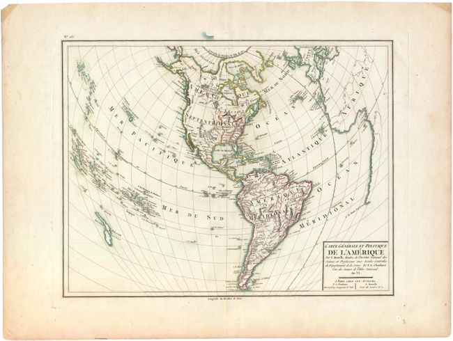
This attractive and finely engraved map focuses on North and South America in an unusual projection with warped lines of longitude. The projection allows the inclusion of Africa and Europe at right, and New Zealand and the Pacific Islands at left. The United States is shown with all states and territories extending to the Mississippi River. Santa Fe is located but the entire Rocky Mountain region and Pacific coast is devoid of detail. There is a good depiction of New Zealand and the Sandwich Islands with a large number of Pacific Islands located and named. Published by Chanlaire & Mentelle with "An VI" in the title, which dates the map to 1798 on the French Republican calendar.
References:
Condition: B+
Sharp impression and original outline color with a couple tiny edge tears well away from map.