Subject: Exploration and Surveys
Period: 1860 (published)
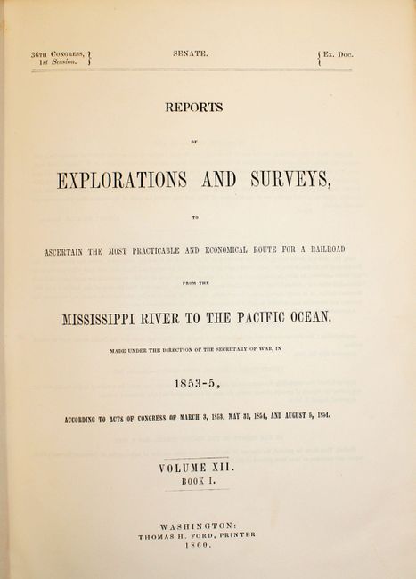
Publication: 36th Congress, 1st Session
Color: Printed Color
Size:
9.5 x 11.8 inches
24.1 x 30 cm
During the 1850s, the U.S. government sponsored an extensive series of expeditions designed to gather information on the vast new territories that had been acquired in western North America. The discovery of gold in California further stimulated westward traffic and heightened the need for a faster and more convenient way to bring the far-flung parts of the country together. In 1853 Congress commissioned the Army's Topographic Bureau to conduct a series of surveys to find a suitable route for a transcontinental railroad. There were six major expeditions; five of them covered the area between the Great Plains and west coast, and the sixth explored the coastal states of California and Oregon. All of these expeditions were accompanied by naturalists and artists to document the landscape, flora and fauna along the route.
The reports, maps and lithographs were published in the 13 volume report "Explorations and Surveys to ascertain the most practicable and economical route for a Railroad from the Mississippi river to the Pacific Ocean."
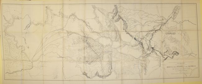
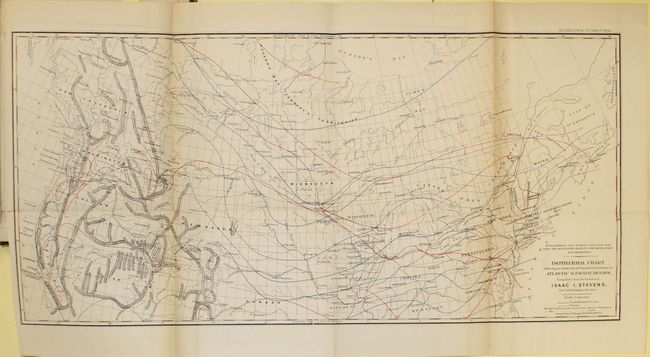
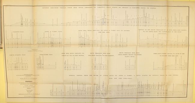
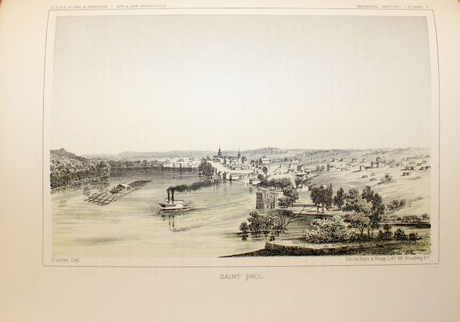
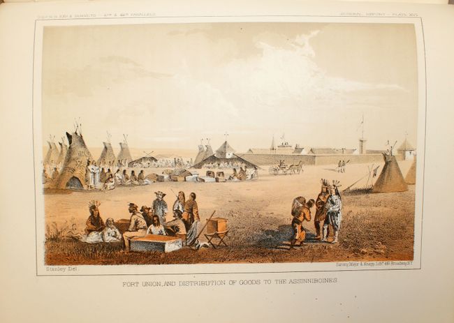
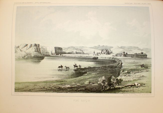
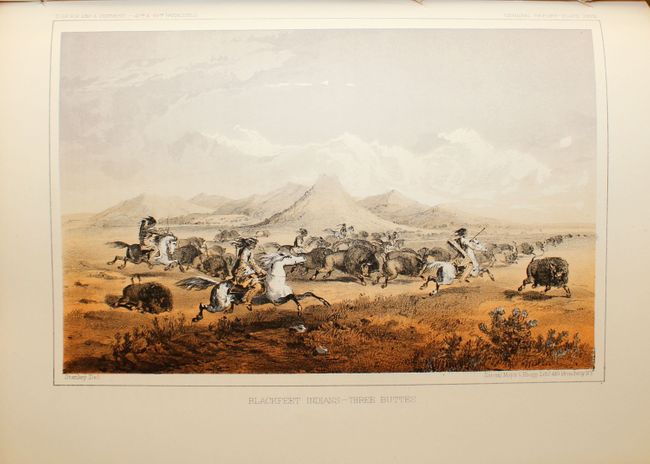
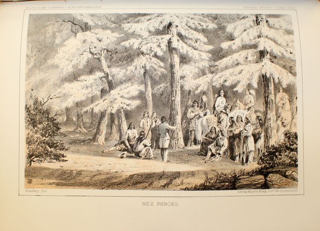
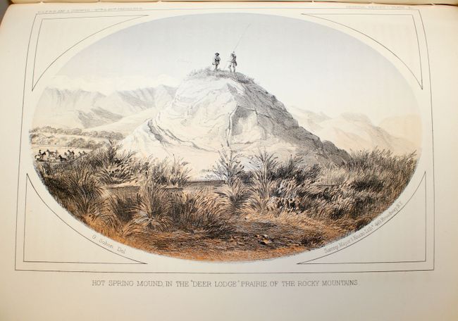
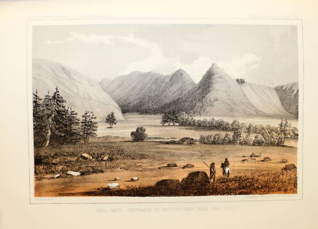
This is the complete Book 1 of Volume XII from the 1860 unnumbered Senate edition, which is a revised and enlarged version of Stevens' narrative first published in octavo format in 1855. This volume describes Stevens' explorations from St. Paul to Puget Sound and contains his general narrative and final report and a superb collection of lithographs by John Mix Stanley, the expedition artist. Among the important lithographs are those that depict St. Paul, Fort Union, Fort Benton, Blackfeet Indians, Fort Owen, Nez Perces, Mount Rainier, and Cantonment Stevens (Corvallis). Included are lithographs of Hellgate (Missoula before there was a settlement), of the Big Hole Valley in Montana, and of the Great Falls of the Missouri. Volume XII is one of the most richly illustrated volumes in the entire series containing seventy tinted lithographs (one of which is folding), and three folding charts including: Isothermal Chart of the Region...between the Atlantic & Pacific Oceans, the General Rail-road Profile, and the important map from Milk R. to the Crossing of the Columbia R. (60.5 x 23.2").
This remarkable map details the entire 1853-1855 surveys conducted to locate a northern route at the 47th and 49th Parallels. Most of the map covers Montana, with extraordinary detail and excellent relief by hachure, the naming of rivers, numerous routes with dates, and interesting topographical commentary. The map not only shows the main party's route, but also numerous routes followed by the various parties attached to the command. Joined on two sheets as issued.
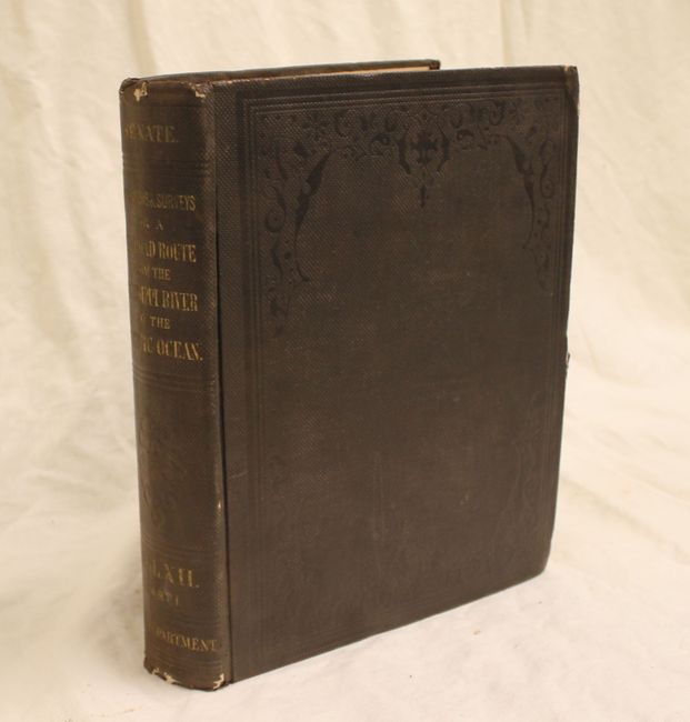
Tall quarto, 358 pp. with appendix and index. Printed in Washington by Thomas H. Ford. Hardbound with brown cloth embossed boards and gilt title on spine.
References: Wheat (TMW) #867; Wagner-Camp #267:2.
Condition: A
Maps, text and plates are all in excellent condition. The maps appear to have only been opened a few times and have just minor toning along a few folds, while the text and plates have a few occasional spots or small stains on a handful of pages. Covers and spine are lightly worn and the edges are bumped.