Subject: India
Period: 1768 (dated)
Publication:
Color: Hand Color
Size:
54.1 x 41.9 inches
137.4 x 106.4 cm
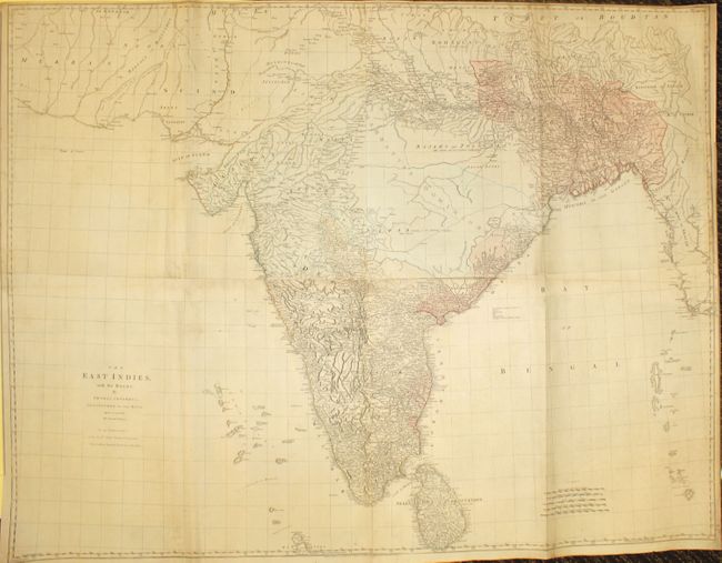
This impressive, large-scale map of India portrays the most up-to-date knowledge of the region for the mid-eighteenth century, prior to the Alexander Dalrymple maps of India in the 1770s. Dedicated to the Directors of the East India Company, the map depicts great detail in southern India and the area of Bahar Benga. Roads, caravan routes, oases, temples, political boundaries, archeological sites, and the topography of the land are all well depicted. By contrast there is very little information in central and northern India, which are noted as "little known and in a manner independent." This is the second edition, published by Robert Sayer. On four sheets, joined.
References:
Condition: B+
Original color with light soiling and minor extraneous creasing. There are professional repairs to several fold separations as well as small tears in the ocean. Two small areas of loss at center of map have been professionally repaired with image in facsimile. The top right sheet has been remargined at right with a small amount of border expertly replaced in facsimile.