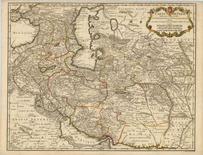
Subject: Persia - Iran
Period: 1724 (dated)
Publication: Atlas Geographique et Universel…
Color: Hand Color
Size:
24.4 x 19.2 inches
62 x 48.8 cm
This handsome map of the region is one of the more important maps in the evolution of cartography in the Persian Gulf in the eighteenth century. The map stretches from the Caucasus through Afghanistan and from the Arabian Desert to the Indus River, and shows a new, still developing shape. The map is filled with impressive detail including roads, bridges, forts, cities, villages, watering places and much else of interest. Finely engraved by P. Starckman with his imprint at lower right. This is a very early state with the word "pour" misspelled in the title as "puor."
References: Couto, Bacque-Grammont & Taleghani #72.
Condition: A
Watermarked paper with just a hint of toning along centerfold.