Subject: Central Europe, Railroads
Period: 1860 (circa)
Publication:
Color: Hand Color
Size:
71.5 x 23.2 inches
181.6 x 58.9 cm
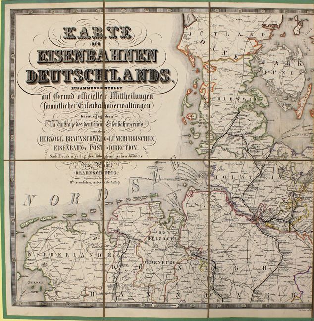
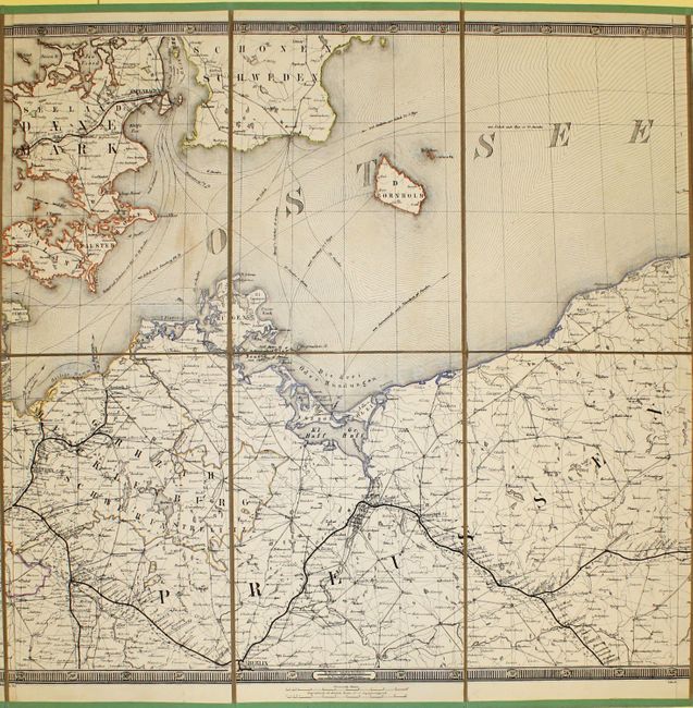
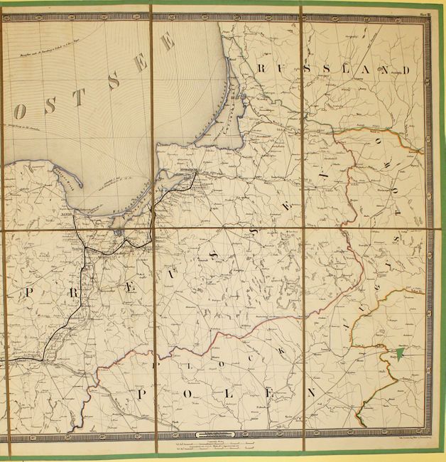
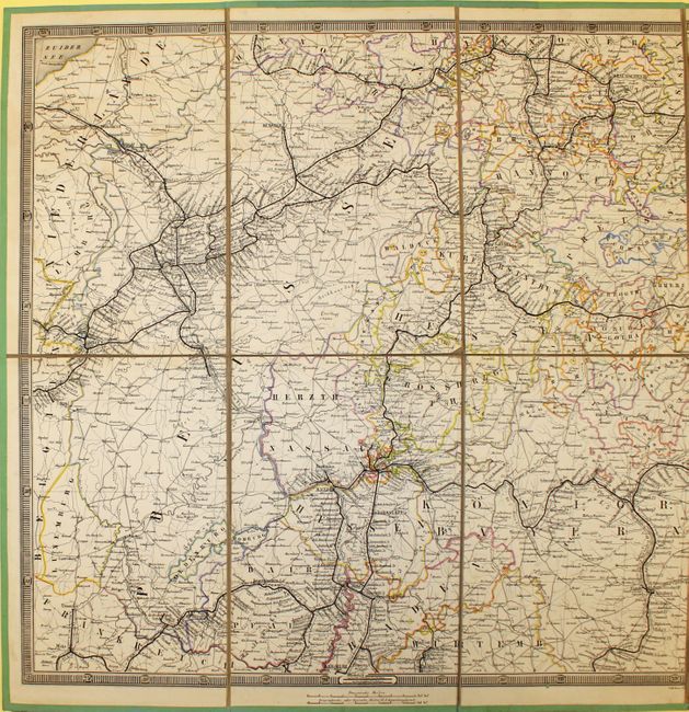
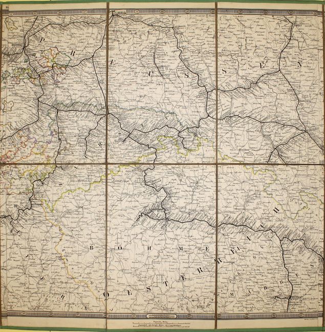
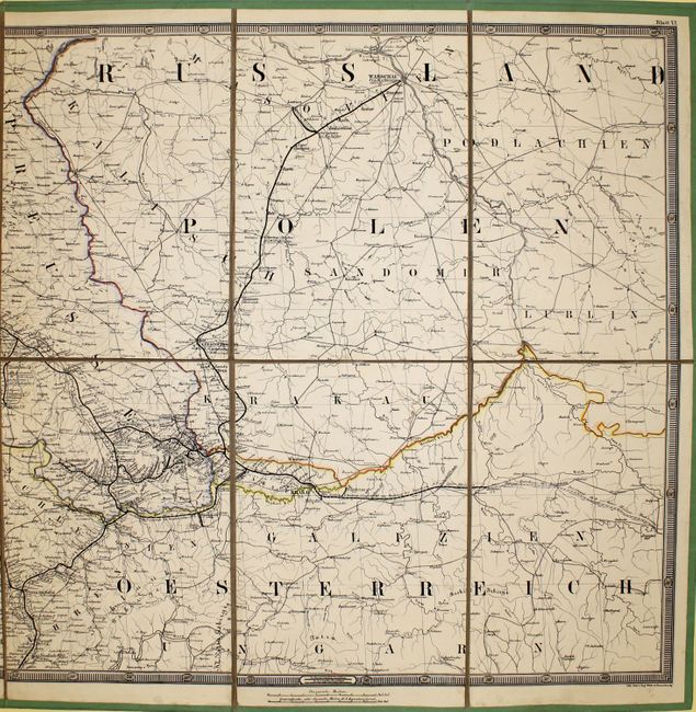
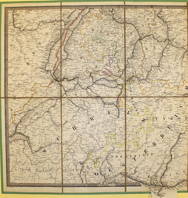
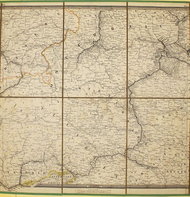
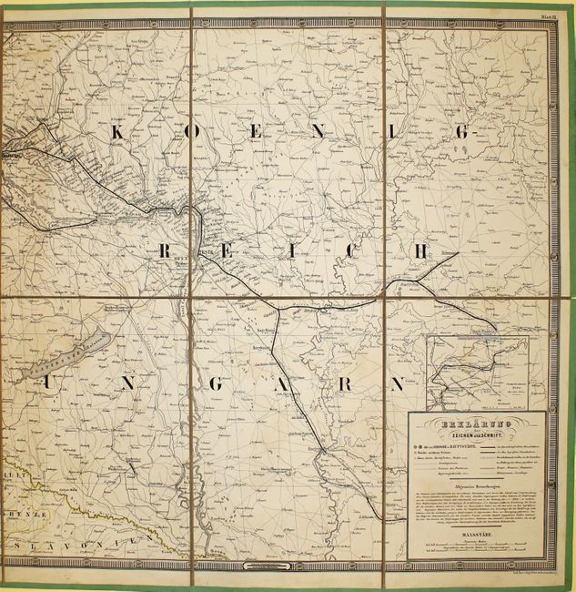
This incredible giant folding map depicts the railroad and roadway systems throughout central Europe. The map extends from the Baltic Sea in the north to Venice, Italy in the south, and from Luxembourg in the west to past Warsaw in the east. There is extensive detail of the railways, including those planned and under construction, with distances between stations noted. A legend at bottom right also identifies cities of various sizes and boundaries between provinces and countries. First published in 1853, this is the 2nd "improved" edition. Drawn by C. Glindemann and lithographed by August Wehrt. Printed on 9 sheets, dissected and mounted on old linen in three horizontal pieces, each with its own full keyboard style borders, with green paper edging. The size is for each horizontal piece - if fully assembled the map would measure approximately 71.5 x 70".
References:
Condition: A
Original hand color with very minor soiling. A few corners and edges have slightly detached from the linen. Overall a bright, lovely example.