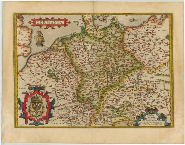
Subject: Central Europe, Germany
Period: 1573 (published)
Publication: Theatrum Orbis Terrarum
Color: Hand Color
Size:
19.9 x 14.3 inches
50.5 x 36.3 cm
Elegant map of the German Empire, which at the time included the Netherlands and Belgium, stretching from Calais to the Wista River in present day Poland, and south to the Adriatic Sea. Ortelius based this beautiful map on Christiaan Sgrothen's map of 1565. The title is enclosed is a strapwork cartouche, below which sails a large ship, and two large cartouches incorporate the royal coat of arms and scale of miles. Dutch text on verso.
References: Van den Broecke #56.
Condition: A
Original color on watermarked paper with some damp stains in blank margins that just touch map border in corners, with some resulting areas of paper weakness confined to blank margins. There is an archivally repaired hole in bottom corner, far from map. French manuscript writing on verso opposing the Dutch text.