Catalog Archive
Auction 142, Lot 49

"A Chart of the World on Mercator's Projection Shewing the Principal Ocean Steam Routes, the Submarine Telegraphs &c", Stanford, Edward
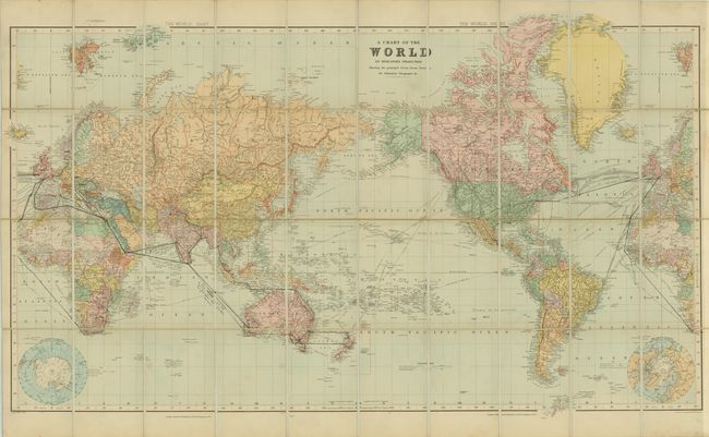
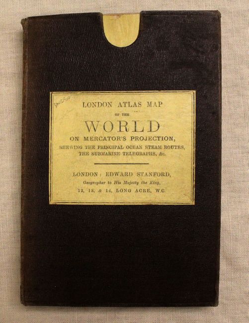
Subject: World

Period: 1900 (circa)

Publication:

Color: Printed Color

Size:
43.8 x 24.6 inches
111.3 x 62.5 cm
Download High Resolution Image
(or just click on image to launch the Zoom viewer)

This very detailed map of the world on Mercator's projection shows extensive steam routes and underground cables. Filled with detail, the map delineates political boundaries and displays cities, rivers and topography. Inset maps at bottom show the Artic and Antarctic regions. Published by Edward Stanford 12, 13, & 14. Long Acre, W.C. Dissected and backed in linen with a brown cloth case.

References:

Condition: B

The map is clean and bright with minor soiling and some ink notations in the image from a previous owner. Pocket case is lightly worn and sunned on the edges.

Estimate: $300 - $400

Sold for: $180

Closed on 11/28/2012

Archived