Catalog Archive
Auction 142, Lot 461

"Carte pour l'Intelligence de l'Histoire d'Angleterre ou on Remarque les Conquestes de Cette Monarchie dans la Plus Part des Etats de l'Europe...", Chatelain, Henry Abraham

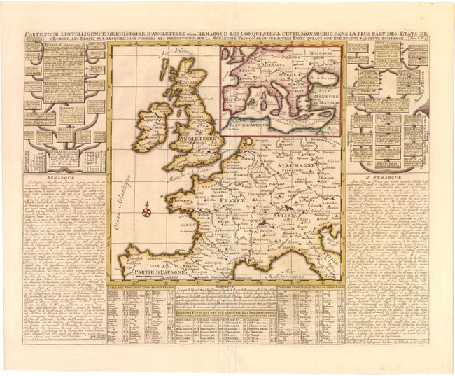
Subject: Western Europe

Period: 1708 (circa)

Publication: Atlas Historique…

Color: Hand Color

Size:
18 x 13.8 inches
45.7 x 35.1 cm
Download High Resolution Image
(or just click on image to launch the Zoom viewer)

This interesting sheet contains a map of western Europe (10.5 x 10.7") surrounded by detailed information about England. The title indicates that the map relays the history of England and its conquests within Europe. The map includes: two family trees of the English monarchy; three tables outlining the major states and cities of Europe, as well as those states that were conquered by England; and historical notes. The map also features a compass rose and an inset showing the whole of Europe and the Mediterranean identifying the route of Richard the Lionheart on his Crusade to the Holy Land. The map is marked, "Tome 2 n. 46."

References:

Condition: A

Watermarked paper with a hint of offsetting.

Estimate: $220 - $300

Unsold

Closed on 11/28/2012

Archived