Subject: Southern Scotland
Period: 1654 (circa)
Publication: Theatrum Orbis Terrarum sive Atlas Novus
Color: Hand Color
Size:
19.6 x 14.9 inches
49.8 x 37.8 cm
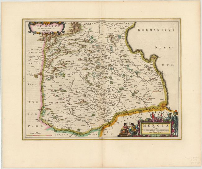
Beautifully engraved map of the historic county of Berwickshire within the Scottish Borders. This map, based on the cartography of Timothy Pont, famous surveyor of Scotland in the late sixteenth century, identifies mountains, rivers, forests, castles, major towns and villages. Modern-day Berwick-upon-Tweed and the now ruined Berwick Castle are located at the bottom right. Now in Northumberland, England, the castle was once one of the most important strongholds in the area, due to its location in the heavily disputed border country between Scotland and England. Two elaborate title cartouches, one Latin and the other English, decorate the map. The bottom cartouche is flanked by knights in armor and soldiers. Latin text on verso.
References: Phillips (Atlases) 5941, v.5 #7.
Condition: A
Attractive color with faint offsetting and wide margins. A short centerfold separation at bottom has been backed in archival tape.