Subject: Southern Scotland
Period: 1654 (circa)
Publication: Theatrum Orbis Terrarum sive Atlas Novus
Color: Hand Color
Size:
19.9 x 15.5 inches
50.5 x 39.4 cm
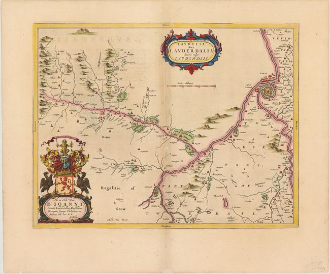
This lovely map shows the district of Lauderdale in southern Scotland, near the confluence of the rivers Lydyrr (River Leader) and Tweed, and includes great detail of the rivers, cities, villages and castles. Situated above Lauder is The Fort, which now is the location of Thirlestane Castle. Blaeu's rendering is based on the work of Timothy Pont, who conducted an important survey of Scotland in the late sixteenth century.
References: Phillips (Atlases) 5941, v.5 #6.
Condition: B+
Attractive color and wide margins with slight toning along centerfold and show through of text on verso. One small hole and a few small areas of paper weakness along the centerfold have been professionally repaired.