Subject: Southern Scotland
Period: 1654 (circa)
Publication: Theatrum Orbis Terrarum sive Atlas Novus
Color: Hand Color
Size:
20.6 x 16.2 inches
52.3 x 41.1 cm
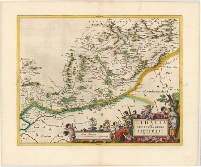
This beautifully engraved map covers the Liddell River valley on the border of Scotland and England. The map, based on the work of Timothy Pont, famous surveyor of Scotland in the late sixteenth century, includes great detail of the rivers, cities, villages and castles including Hermitage Castle, known as the 'the guardhouse of the bloodiest valley in Britain' and the 'Strength of Liddesdale'. The Scots' Dike is prominently shown (here labeled March Dyik). This important earthwork was constructed by the English and the Scots in the year 1552 to mark the division of the Debatable Lands and thereby settle the exact boundary between the Kingdoms of Scotland and England. Latin text on verso.
References: Phillips (A) 5941, v.5 #9.
Condition: A
A dark impression with lovely color and wide margins. There is a hint of printer's ink residue and offsetting. There is an archivally repaired tear in top blank margin and an ink mark in right blank margin.